
Weather
Several Louisiana counties under severe thunderstorm warning
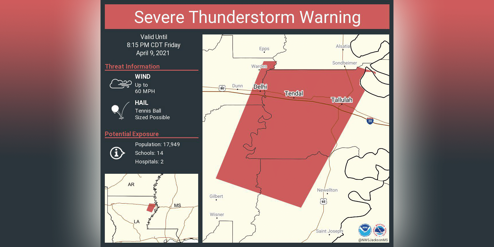
A SEVERE THUNDERSTORM WARNING REMAINS IN EFFECT UNTIL 8:15 P.M. CDT FOR NORTHWESTERN TENSAS, MADISON, NORTHEASTERN RICHLAND AND
NORTHEASTERN FRANKLIN PARISHES.

At 6:58 P.M. CDT, a severe thunderstorm was located near Newlight, or 13
miles east of Winnsboro, moving north at 30 mph.

HAZARD...Tennis ball size hail and 60 mph wind gusts.

SOURCE...Radar indicated.

IMPACT...People and animals outdoors will be injured. Expect hail
         damage to roofs, siding, windows, and vehicles. Expect wind
         damage to roofs, siding, and trees.

This severe storm will be near...
  Bakers around 720 PM CDT.
  Delhi around 735 PM CDT.
  Tendal and Waverly around 740 PM CDT.

Other locations impacted by this severe thunderstorm include
Richmond.

PRECAUTIONARY/PREPAREDNESS ACTIONS...

For your protection move to an interior room on the lowest floor of a
building.
See a typo? Report it here. 
Continue Reading